
Photos and Text by Ralph Naranjo
Copyright 2013 SDMC, Inc.
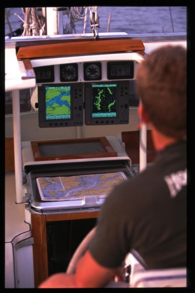
With dedicated radar on one display and a chart plotter on another, the person on watch has much greater versatility. Note the paper chart backup that remains in play.
Now that we have more position information and detailed cartography at our fingertips than ever before, we also see headlines about vessels running into islands and crews coming to grief while short cutting risky shoals. The big question is whether this is a hardware issue, software shortfall or operator error—and the answer is it’s a little of each.
A couple of years ago Andrew Short the Australian owner/skipper of Pricewaterhouse Coopers PwC (ex-Shockwave V),was staring at his chart plotter as he drove the powerful RP 80 onto the north end shoals of Flinders Islet just south of Sydney, Australia. He and his crew were doing well in the annual 92 mile coastal overnight race, and when it came to rounding the island and heading for home, Short favored his GPS/Plotter over a visual confirmation of what lay ahead. He paid for the shortcut in seamanship with the loss of his yacht and his life. Fellow crew member and well respected sailor Sally Gordon, also drowned in the incident. The follow up scrutiny of the tragic accident was carried out by the Cruising Yacht Club of Australia and they determined that in addition to over reliance on a single source of navigation input, the crew had been poorly organized and the basics of good seamanship had been all but ignored.
The Cruising Yacht Club of Australia, a long standing advocate of offshore racing did extensive research and produced the Flinders Islet Race report. Among the key contributing factors that led to the disaster is an account of why the GPS/Plotter was portraying inaccurate information at the time of the incident. More than supposition, their findings were reaffirmed by yacht navigator/ hydrographic surveyor Greg Halls who was working on a tunnel drilling ship near Bothnay Bay. Halls noted that the crew had to suspend drilling operations at about the same time that PWC collided with Flinders Islet. The drill ship found that the GPS signal was too inaccurate to be used for precise “dynamic positioning” or station keeping. What had happened was formally referred to as a “dilution of precision,” and in this case it was caused by satellites being too close to the horizon and angles of separation that were too acute. The resulting position error had grown from a few meters to over 100 meters.
This is an especially big concern for those running a GPS in “autonomous” mode, a case in which the onboard receiver is not linked to the WAAS system (US and Canada) or other differential based system (DGPS). In the autonomous mode a GPS receiver basically discerns position fixes on its own, and does not compensate for ionosphere changes, minute time anomalies and other factors affecting fix accuracy. When a GPS operates in a WAAS mode, it receives a correction signal as well as fix data from the GPS satellite array. These valuable corrections arise from a series of ground stations that constantly monitor GPS accuracy. The WAAS system continually compares the known location of these terrestrially based monitors and links them into the a Wide Area Augmentation System (WAAS) which sends a correction signal to satellites that deliver appropriate offsets to compensate for regional GPS error. Individual WAAS equipped GPS receivers read both the fix data and the correction, and the unit’s position readout becomes more accurate. At the time of the Flinders Islet incident the GPS aboard PwC was only capable of providing fixes in the “autonomous” mode.

Smart phones with nav apps can be used as remote displays and some can even control what’s displayed. Here a radar and a FLIR picture occupy the screen. These very small screen and non-waterproof nav tools are vulnerable to the elements.
A couple of takeaways from this tragedy underscore the importance of regularly noting whether or not your GPS is working in WAAS mode, and why the satellites page on the menu deserves regular scrutiny. When you decide to gamble on GPS accuracy, such as when opting to enter an unmarked, surf swept inlet in overcast conditions, it’s time to check the signal quality. Receivers use varied graphic and numeric scales to display signal strength, signal to noise ratio and dilution of precision (DOP). Some show a bar graph, others display accuracy in feet or meters, and some give a polar diagram of satellite altitude and azimuth. The bottom line is you need to know what these readouts look like whether or not your GPS is providing category A (25’ or less) accuracy. Another handy practice is to regularly pass close at hand to a fixed day beacon and confirm its location with your GPS while also checking the signal quality page.
A potential flaw in the GPS system is the weak signal that receivers must cope with. The ability of modern GPS units to detect these low power RF signals traveling over 12,000 miles though space, is a testimony to contemporary circuit design. However, there are times when other, much closer, RF sources can significantly degrade if not obliterate the signal. In last year’s Technology Quarterly issue of the Economist Magazine, there’s an attention grabbing tale of a GPS system that had frustrating daily short lived failures. The big news was it was the system at Newark Airport in New Jersey. The FAA investigated for two months and after some high tech digital sleuthing they found a guy plying the New Jersey Turnpike with a cheap GPS jammer he bought to keep his boss from knowing where he and his truck were headed! The point here is that the GPS signal can and does get degraded by natural (P static caused by lightning) and intentional and unintentional manmade sources. Most of the time it’s brilliantly accurate, but before you bet the farm, or in this case your boat and the wellbeing of her crew, check and see how the signal strength and accuracy stack up.

Some digital chart sources offer do-it-yourself edit capability that can be shared with others. Extreme care should be taken when using such data.
“Zone of confidence” is another navigators concern highlighted by Flinder’s Islet grounding, but it doesn’t have anything to do with GPS accuracy. It’s all about the accuracy of the charts you use and how well they comport with the fix being placed on the paper or LCD screen. When all goes well, the GPS coordinates read out in a lat/lon couplet that places you within a dozen meters of your actual location on the planet. The rub lies in the reality that the planet is not a perfect sphere and position fixing sprinted ahead of the survey work behind the charts we use. The result is a varying offset between real planet features and not always so accurate cartography. This was no big deal when sailors turned the micrometer drum on their sextant and came up with “good” fixes that had an accuracy of a mile or two. But with today’s GPS accuracy, at least when all is working well, we assuming that we can thread the eye of a needle and this is why we must view zone of confidence (ZOC) like its partner of dilution of precision—as factors that can and do taint the perfection we expect.
All charts aren’t made the same way and once US sailor crosses international boundaries into less developed parts of the world, the accuracy of the charts usually drop significantly. It’s interesting to note that the start of the first Gulf War was held off while the DOD re-charted the waters and coastlines of the gulf—seas that had been sailed for millennia. The reason was that there’s little sense in putting pin point accurate electronic fixes on inaccurate graphic representations of the globe. The International Hydrographic Organization has worked hard to encourage developing nations to shoulder their responsibility for survey work, a costly and tiring process regulated globally by the UN and its maritime arm the IMO. Needless to say it’s a work in progress, and innovators like Navionics founder Giuseppe Carnevali have taken the challenge to heart, creating a chart refinement approach all their own.
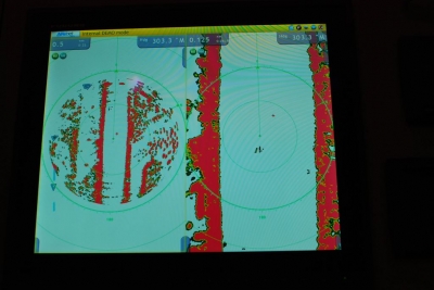
A dual range radar delivers real time images on two scales. In this case, one antenna sends and receives signals covering 3 mile and ½ mile ranges. Because radar is a self-contained aid to navigation, it gets high reliability marks among users.
Carnevali delivers a clear message when he states that his company scores a 99.9% when it comes to cartographic accuracy. What that means is that of the billion bits of information in their chart data base about 10 million are incorrect. Astounding as this may seem, it’s better than many other digital map providers simply because Navionics takes the information coming from governmental hydrographic offices and adds much more detail. At first glance, sailor may wonder why extra work must be done to charts that already have cost millions to make. In a way it’s like buying a new boat and needing to fair the keel and spray on a racing finish.
The bottom line is anchored to the fact that nautical charts aren’t made for small boat recreational sailors. They are developed for the merchant marine and navies of the world and to a lesser extent for shoal draft commercial traffic. But like the ICW and dredged channels around the world they also serve the needs and interests of the recreational sailor. The fact that ships are deep draft craft and never intentionally skim the shoals answers why there’s often less detail and more unmarked obstacles outside channels than within their confine. This periphery that borders these deep water channels are often the favored haunt of racing and cruising sailors, and over time a trial and error process often detects “unmarked” obstructions. These may eventually be added to the cartographers ever growing list of features to be marked. And this brings us to another of Carnevali’s favorite talking points. It usually takes 2-5 years for an intentionally or unintentionally discovered bottom feature to appear on government charts. As would be expected there’s a detailed vetting process that’s put in action once the “new rock” is reported. Validation requires conformation by a survey vessel and then there’s the procedure to place the authenticated rock, wreck, ledge or other sounding perturbation in the new updates file that will eventually be turned into an appropriate graphic on the corresponding chart(s). Navionics has been adding their own changes to their charts and just recently have moved into a bold new program that allows users to network their own observations into the system. Navionics chart users can update their own charts and forward their findings to company headquarters. Selected semi/pro benthic surveyors do extensive sounding and bathymetric observation passing their findings onto Navionics. This from the field data gets reviewed and may be included in Navionics next chart update. Other companies are offering DIY micro charting software that allow you to convert your own sounding into digital chart data and share it with friends. With the increase in data comes questions about its reliability.
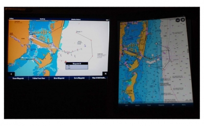
Vector charts (left) and a Raster scan of the same area (right) offer a slightly different picture of the same coastal region. Those familiar with NOAA paper charts and fond of Chart 1 symbology tend to favor raster cartography. Those utilizing radar overlays will find vector versatility more advantageous.
Read the disclaimer
All of the independent cartographers and digital plotter manufacturers are quite up front with their clients. Every time you turn on a plotter or boot up some navigation software a pithy disclaimer jumps onto the screen and no chart appears until you tap the “I agree” check box. This prelude reminds users that the cartography may not be perfect, the position fix accuracy may vary and the GPS guided cursor should be an aid to navigation not the sole source of determining location.
Decision Making remains a key part of the navigators art. In addition to concern about occasional dilution of precision inherent with the GPS system and the impact of what has been labeled zone of confidence we have a human factor to contend with. And despite the huge strides forward in technology there are still occasions where vital information is ignored or unnoticed and the sea capitalizes on the omission.
The more complex a networked electronic navigation system becomes, the more important it is to have quality technicians install and remain available to maintain the system. Complexity is the down side of a modern integrated sytem.
Last year’s Ensenada Race tragedy appears to have been an instance of such operator error, and a misuse of good technology. But with the loss of all hands we’ll never know exactly what decision making process caused the crew to select a course that led them directly into the cliffs and shoals of Northern Coronado Island. Initially, the Coast Guard and others assumed that the debris found floating in the ocean off Baja meant that the Hunter 376 Aegean had been run down by a merchant ship. But when a Spot electronic tracker record came to light, the speculation shifted from looking through AIS shipping data to looking for the hulk, engine and ballast at the base of the island’s surf swept cliffs.
The tracker revealed a sobering bread crumb trail that played out in 10 minute intervals. It scribed a straight as an arrow run from just south of Newport to the bold northern face of the island. The speed was a uniform six knots and since the breeze had quit it was reasonable to assume that the crew aboard the Hunter had capitalized on the under power provision of the cruising class rules, and set a rhumb line course for Ensenada but failed to note the islands that lay in the way. The 0130 no one on board apparently saw the island or was able to alter course in time and the result was a fatal allision (a collision with a non-moving object). Apparently one of the crew was able to set off the emergency alert feature on the Spot tracker about ten minutes after the vessel hit the island. The GEOS emergency coordination center, a private sector service (not part of the COSPAS/SAESAT system) received a short distress signal but no position location. This was likely due to the fact that the unit was now in the water and GPS reception was degraded. Instead of notifying the USCG an email was sent to the primary contact’s email and not noticed until the next morning. Sadly a review of the tracking data would have pinpointed the position of the boat. SPOT has already amended how it will handle such situations in the future and regulators are delving into operating parameters for tracker/beacons.
Vector cartography is layered and allows a user to add or subtract detail. Clearing away extraneous information makes sense but the operator must be careful with regard to what’s omitted.
Lessons learned
More often than not, operator error plays a key role in grounding accidents, and when the vessel is on a rocky lee shore the outcome is usually catastrophic. Cutting corners and passing closer to dangerous shoals has become more prevalent, part because of more accurate aids to navigation and the reduction of uncertainty among navigators and skippers. Long valued sea sense about the peril of embayment and threat of a lee shore are less adhered to. Among the important issues to consider is the significant wave height (the average of the 1/3 highest waves) and the understanding that in any 24 hour period there’s likely to be a wave twice that significant wave height. A six foot wave begins to feel the bottom and steepen in 60 feet of water. It can break in water twice as deep as the wave is high (wind direction, current flow and wave period also influence when the crest topples). When the oscillatory energy of a deep water swell morphs into a plunging breaker, the energy transfer is immense. And when a vessel is caught in the translatory shift all bets are off. Staying off a lee shore is the job of the skipper/navigator and instruments may help but the final test lies in the decision made.
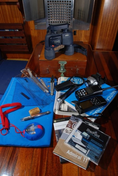
Navigators have their own personally tailored collection of tools, and today they include electronic equipment along with sharp pencils. Maintaining a no-electrons-needed backup navigation routine is still worthy of the effort.
Don’t get me wrong, I’m not impugning the value of GPS based navigation aids and networked systems. These comments relate to the user interface and how, despite great advances in position fixing technology, the human decision making factor remains crucial. And whenever any mariner, whether they be a recreational sailor of the master of a super tanker, makes a decision they need to be aware of how it jibes with the International Navigation Rules (AKA COLREGS). For example, these regulations stipulate that in good visibility a visual watch must be maintained and only in limited visibility does electronic navigation supersede. Nighttime conditions with clear to partly cloudy sky does not qualify as limited visibility. Radar, AIS and FLIR equipment are valuable aids but visual watch keeping reigns supreme. Paper charts remain an important tool for many using digital navigation systems. Having a navigation back plan and multiple means of position fixing is at the heart of good seamanship.
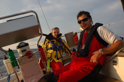
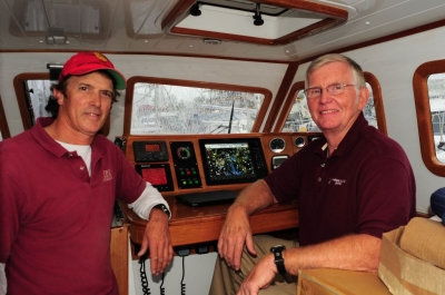
Offshore, headed for Bermuda, the team on watch tracks progress toward the Gulf Stream using a pedestal mounted MFD.
Ralph Naranjo turned a youthful interest in water sports into a lifelong commitment. Time spent in small boats set the stage for a family voyage around the world, and his early career as a teacher and school administrator segued into more marine oriented writing, lecturing and training. When he and his wife Lenore set off with their two children on a five year voyage across three oceans, neither anticipated how much the experience would reshape their lives.
After the cruise Ralph managed a full service boatyard and marina, wrote Wind Shadow West, a narrative about family life and long distance passage making, and found time to become involved with US Sailing’s safety at sea training. Later as the Vanderstar Chair at the US Naval Academy, he oversaw the sail training program and led the Academy’s effort in the development of a new fleet of Navy 44s. He’s currently, the Technical Editor for Practical Sailor magazine and the Electronics Editor for SAIL magazine. He’s finishing up a book on seamanship for McGraw Hill, and will regularly share seamanship insights on this blog site. Ralph holds a deep respect for the volatility of the ocean/air interface. He’s cruised and raced vessels made of wood, fiberglass and aluminum, labels himself more sailor than power cruiser, and is quick to point out that self-reliance is the most valuable asset found among ocean voyagers.

